New aerial imagery: Kentucky tornado leaves trail of damage
Severe storms left dozens dead and damaged homes across the Midwest and South
Welcome to Views From Above, a newsletter bringing you satellite imagery snapshots of major world events. Today, we are looking at the aftermath of a deadly tornado in Kentucky and other recent storms across the US.
Several areas in the midwestern and southern US continue to endure storms and hazardous weather conditions, which meteorologists warn will persist for days. In addition to heavy rain and high winds, residents are facing tornadoes and hail large enough to cause injury and damage property. Officials report that more than 28 people have died as a result of this recent bout of severe weather.
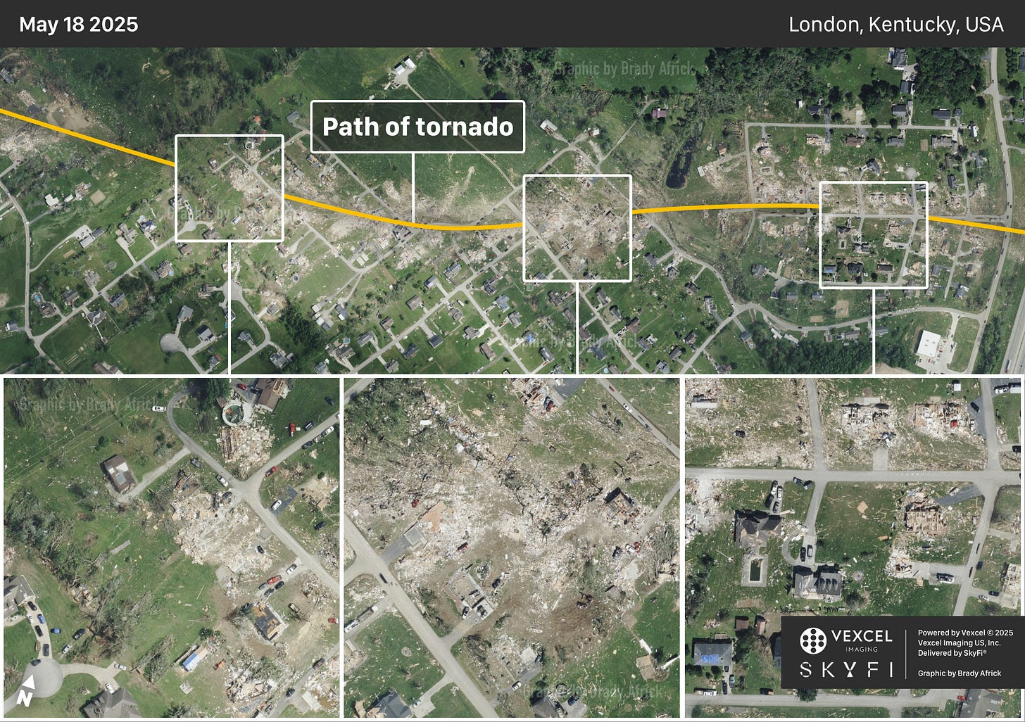
The aerial imagery above shows the aftermath of a tornado that touched down in southeastern Kentucky on Friday. It left a scar of destroyed homes and flattened trees along a nearly 30-mile path that is visible from space. The area above shows just one mile of the tornado’s trail as it passed through London, Kentucky — a city of less than 8,000. Since the tornado struck on Friday, first responders have worked alongside local volunteers to clear debris and help those in need. Disaster relief organizations like the Red Cross are also sending emergency aid to those affected by the storms.
A closer look at this segment of the tornado’s path can be seen in the video below, and a gallery of close-ups is available further down.
This round of severe weather renewed some meteorologists’ concerns over cuts to National Weather Service (NWS) stations, including those that provide weather updates to rural communities. Some stations have cut their overnight shifts, which can be critical to monitoring weather emergencies. To manage the response to this latest string of storms, the NWS station in Jackson, Kentucky — a forecast office that no longer has overnight staffing — called in workers to help coordinate first responders and issue warnings during the night.
NWS’s Storm Prediction Center issued new warnings for several areas of the Midwest and South to prepare for more hazardous weather, meaning the strain on the residents enduring these storms, and weather experts tracking them, is not yet over.


Thanks for reading Views From Above. Subscribe for free to get satellite imagery and news delivered to your inbox. Already subscribed? Share this newsletter with a friend.


