Satellite images of Hurricane Melissa and the aftermath
The deadly hurricane made landfall in the Caribbean as a Category 5 storm
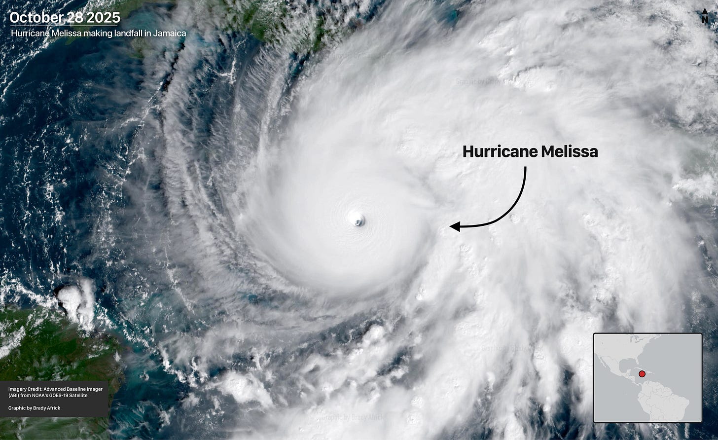
Welcome to Views From Above, a newsletter bringing you satellite imagery snapshots of major world events. Today, we are looking at Hurricane Melissa, a Category 5 storm that made landfall earlier this week.
People across the Caribbean hunkered down in shelters this week in the face of Hurricane Melissa, a violent storm that first made landfall in Jamaica. The storm brought massive flooding, rainfall, and perilously high winds that tore into infrastructure. Local authorities are reporting dozens of deaths as a result, with the toll expected to rise as the storm continues and emergency responders confront the aftermath.
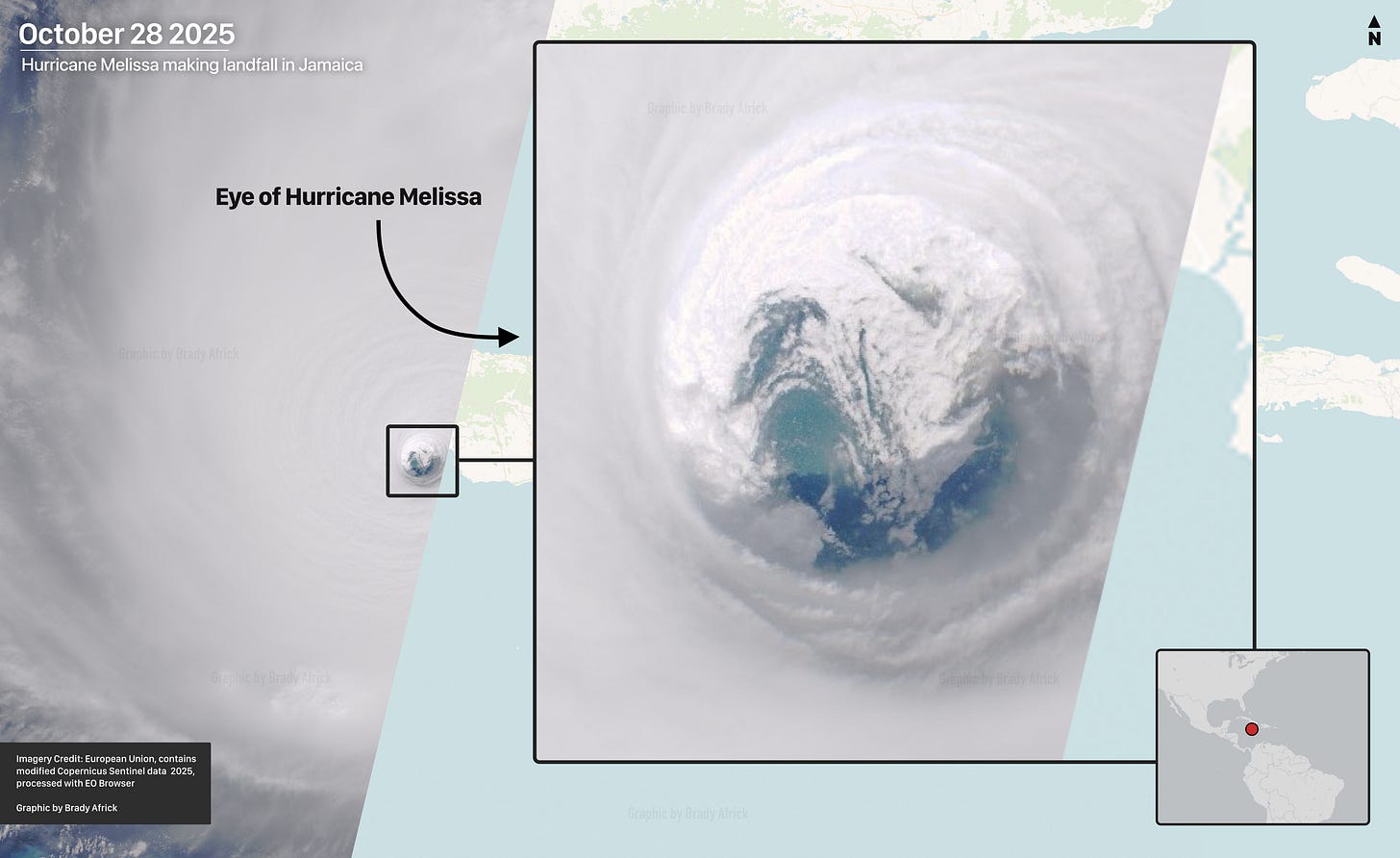
The satellite image below offers a look at the eye of Hurricane Melissa, captured as the storm made landfall in Jamaica. According to the director of the National Hurricane Center, storm-force winds extended for nearly 200 miles from the eye and put at risk communities throughout the Caribbean.
Hurricane Melissa became the third Category 5 hurricane of 2025, and has since proved to be the strongest of this year’s Atlantic hurricane season. Wind speeds from the storm reached 185 mph (297 kph), with sustained winds stronger than Hurricane Katrina.
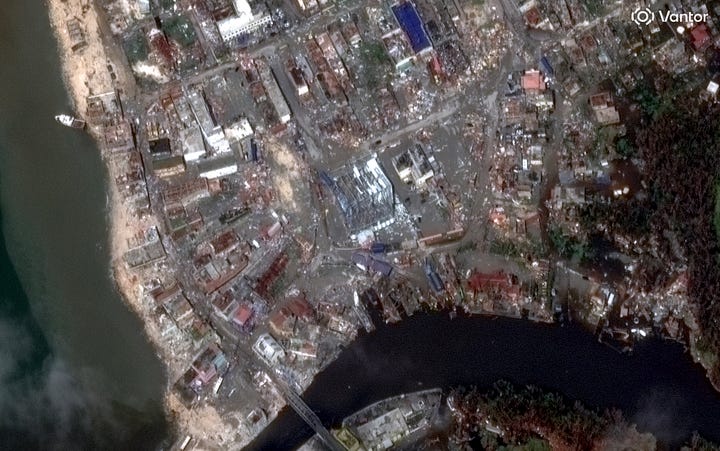
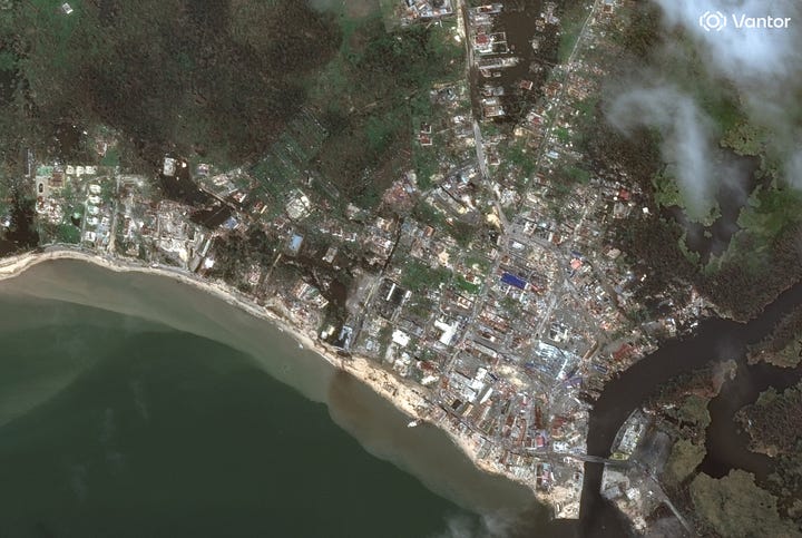
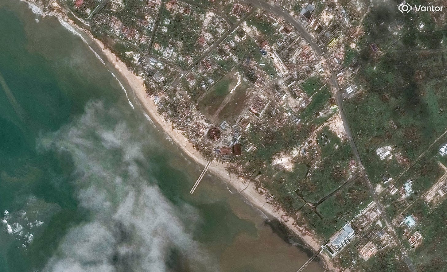
While the storm still rages, countries, humanitarian groups, and international organizations are working to send aid to those impacted. Secretary of State Marco Rubio said that American rescue teams have been dispatched to the region and that the U.S. is in contact with local governments to offer support. The UN is also launching a sea-lift to deliver aid to the region, including essentials like water, sanitation, and personal hygiene kits.
Thanks for reading Views From Above. Subscribe for free to get satellite imagery and news delivered to your inbox. Already subscribed? Share this newsletter with a friend.


