

The latest satellite images of strikes on Iran
US and Israeli strikes targeted sites across Iran, taking out the country’s top leadership and damaging military bases.

Welcome to Views From Above, a newsletter bringing you satellite imagery snapshots of world events. Today, we are looking at the aftermath of US and Israeli strikes on Iran — and Tehran’s retaliatory attacks across the Middle East.
Over the weekend, the US and Israel launched a massive wave of strikes on Iran, damaging military facilities and killing many of the country’s top leadership. Iran responded with missile and drone attacks on U.S. and European bases in the region and nearby countries, including Israel, Bahrain, Kuwait, the UAE, Qatar, and Saudi Arabia.
Here are some of the most striking satellite images from the weekend. For the latest updates, check out the Critical Threat Project and ISW’s daily coverage.
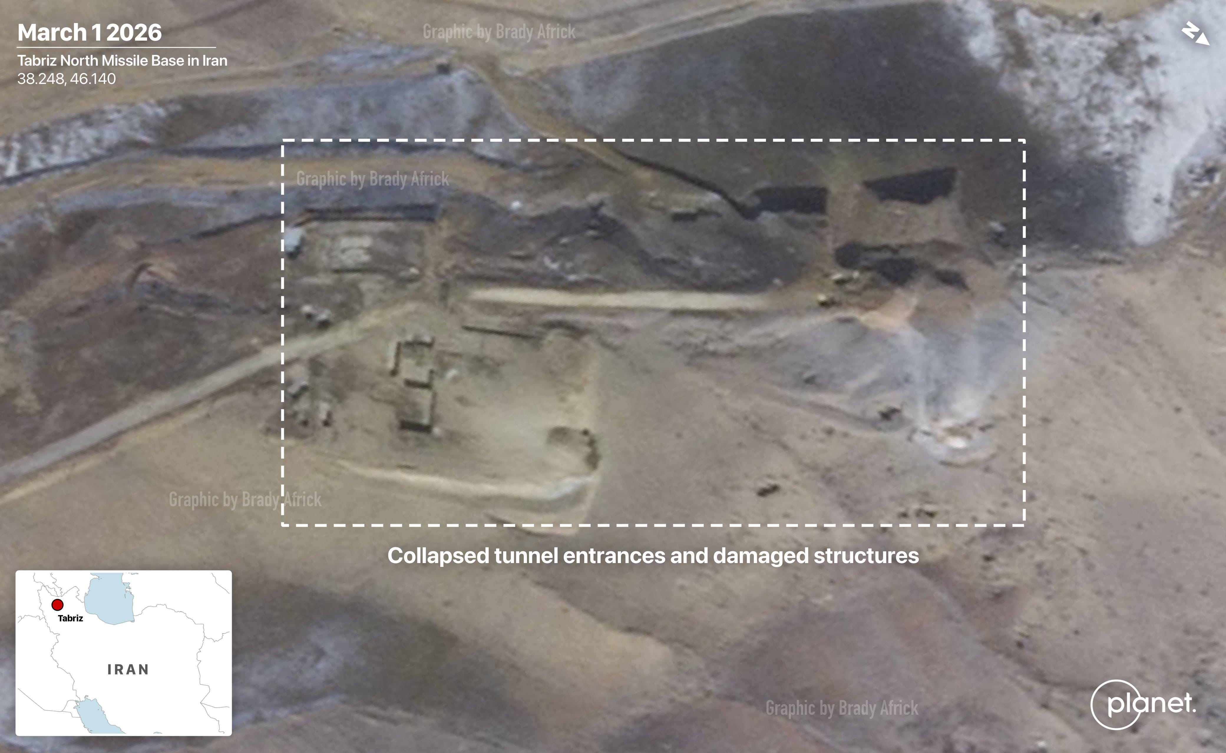
Damage to Iran’s air and missile bases
US and Israeli strikes targeted many of Iran’s air and missile bases, destroying hangars, piercing aircraft shelters, and collapsing tunnel entrances.


Targeting Iran’s navy
In addition to Tehran’s air and missile forces, the Iranian navy was targeted by American and Israeli strikes. President Trump said Sunday that the US destroyed nine Iranian warships.

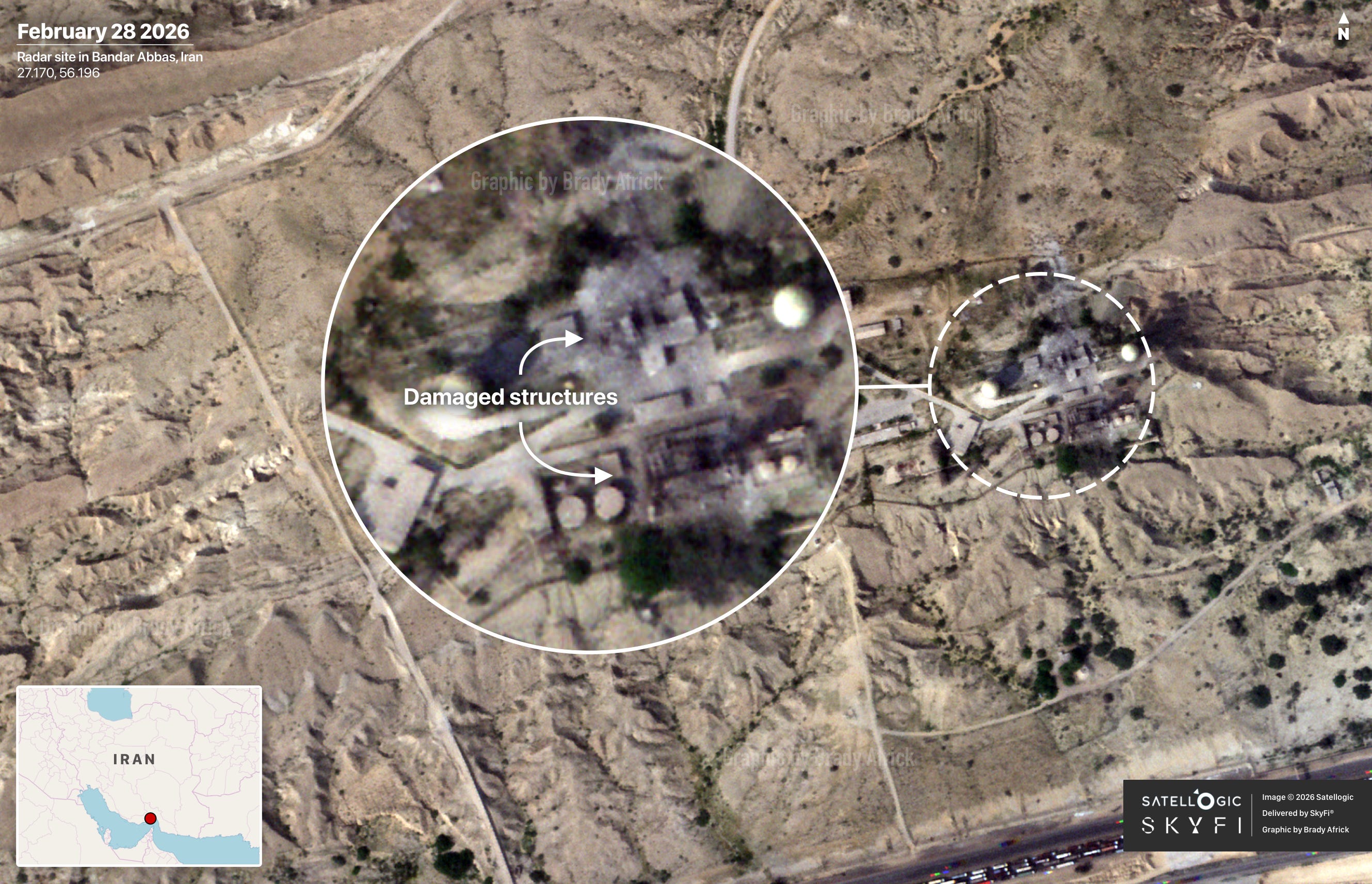
Strikes on Iran’s radar and air defenses
The US and Israel targeted several Iranian radars over the weekend, which hampered Iran’s ability to detect and confront incoming strikes. On February 28th alone, Israel struck at least 11 air defense systems in western Iran, according to AEI’s Critical Threats Project and ISW.

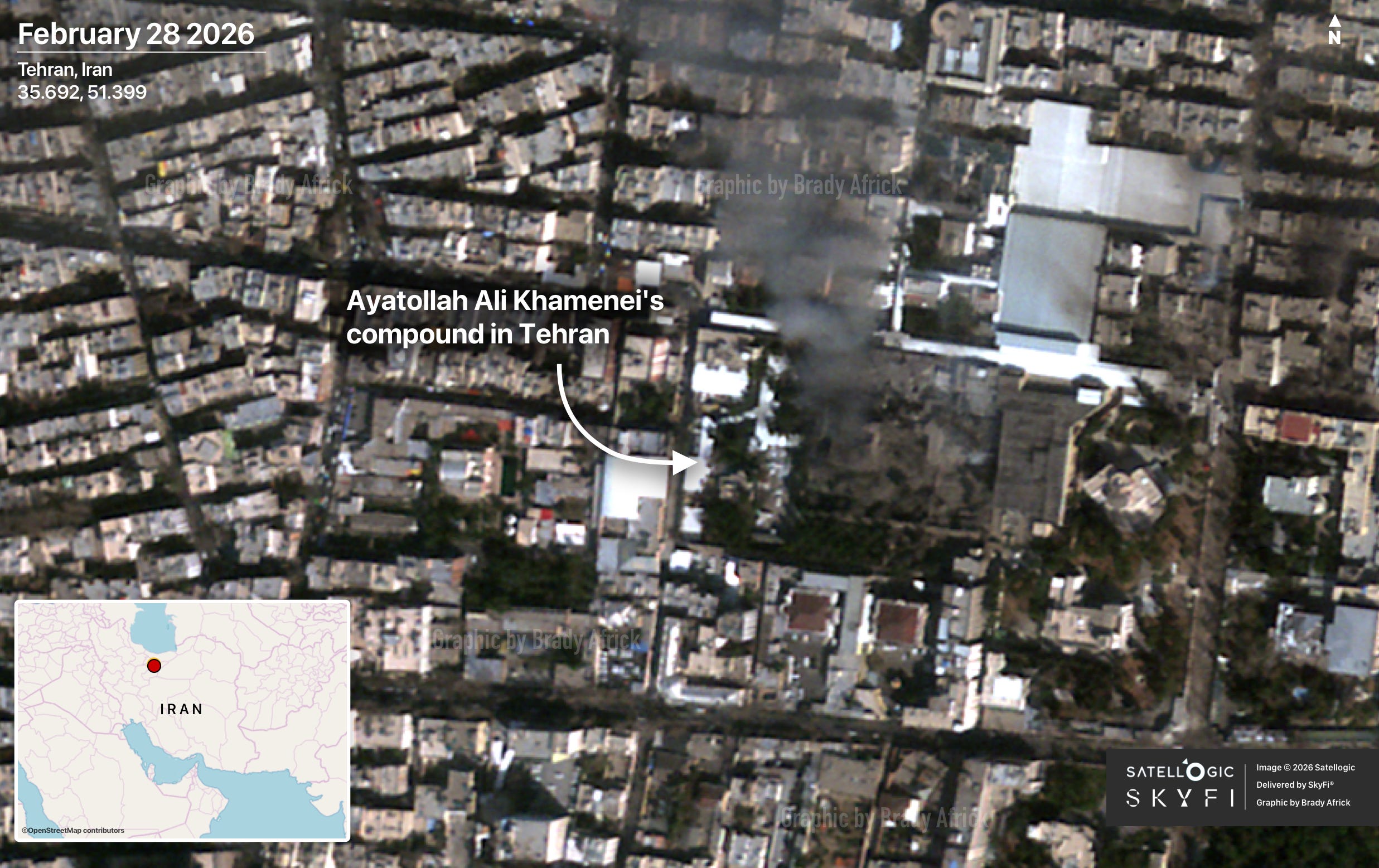
Targeting Iranian government sites
Also a target of the weekend’s strikes were Iranian government facilities, including the former Supreme Leader Khamenei’s compound and law enforcement command facilities in Tehran.
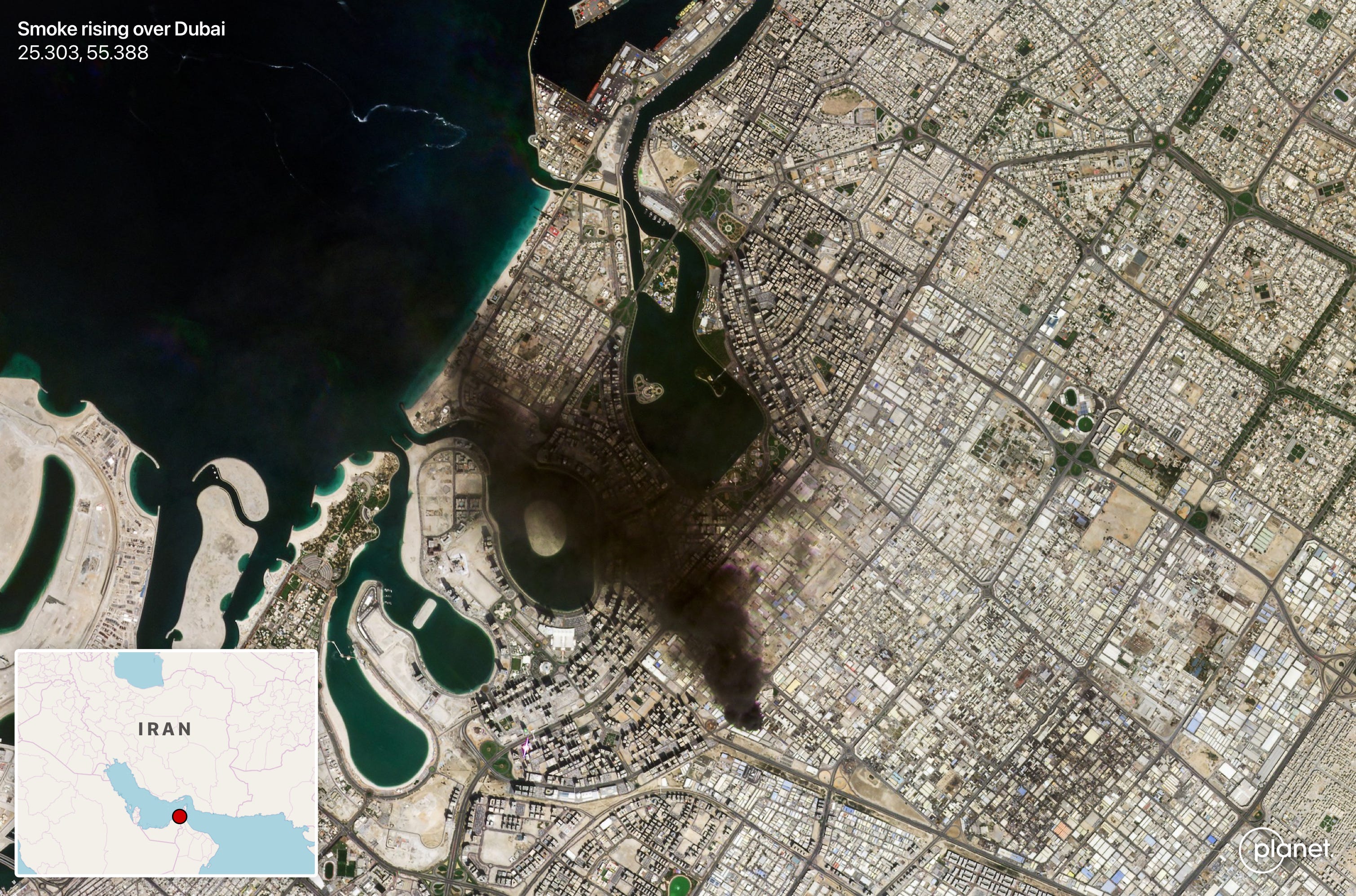
Iran’s retaliation across the Middle East
In response to US and Israeli strikes, Iran launched hundreds of drones and missiles at Israel, U.S. and European bases in the region, and other nearby countries, including Bahrain, Saudi Arabia, the UAE, Qatar, and Kuwait.
Beware of fake satellite images
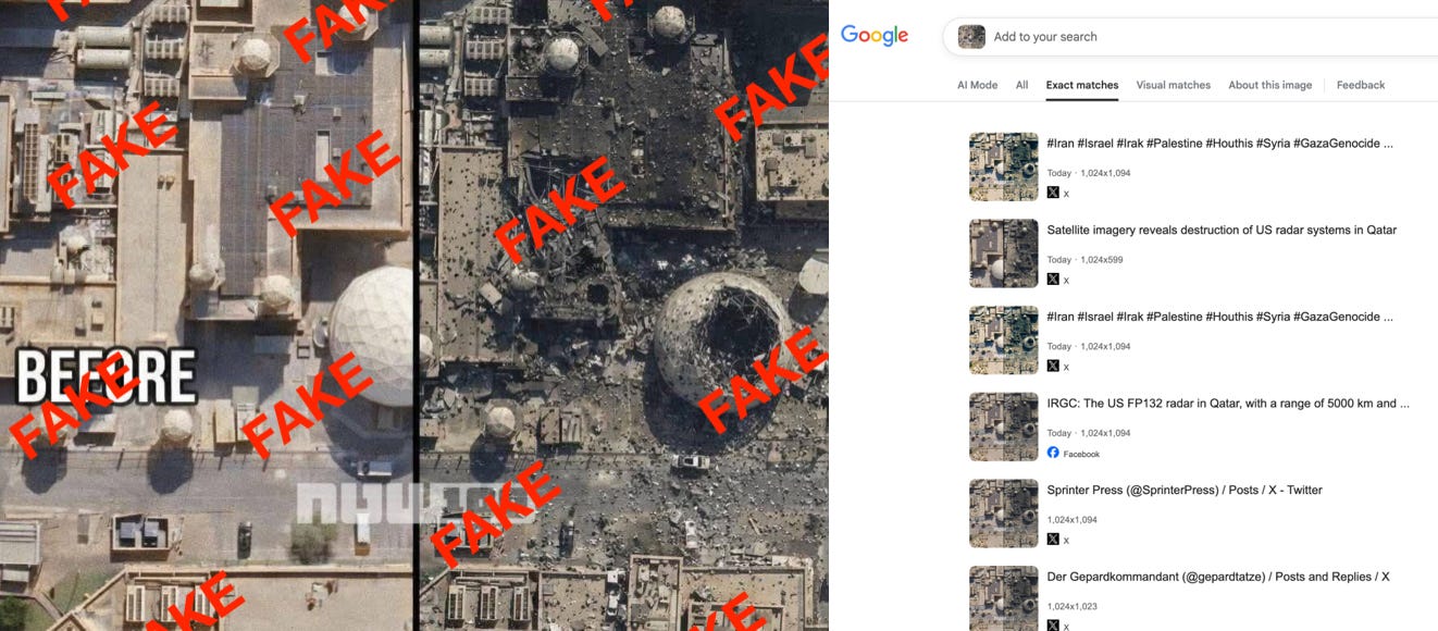
Misinformation spiked over the weekend, and satellite imagery was not immune. The first AI-generated satellite image that I came across purported to be a before-and-after comparison of damage to a US naval facility in Bahrain from an Iranian strike. But it had no visible credit to an imagery provider and showed the tell-tale signs of AI generation: impossible angles and hallucinated details not present in real imagery of the site. When I reverse-searched the fake image, I found it had already spread across social media like a virus, with dozens of posts across various social networks.
AI has made it easier than ever to generate fakes, so double-check what you see and rely on trusted sources for analysis. I wrote last year for TIME on the risks posed by fake satellite images and how we can push back — check out that piece here.
Thanks for reading Views From Above. Subscribe for free to get satellite imagery and news delivered to your inbox. Already subscribed? Share this newsletter with a friend.